Table of Contents
Why You Keep Asking This Question
Are Atlantic Hurricane Seasons Getting Worse? If you’ve watched storms form earlier, climb the category ladder faster, and knock out power for longer stretches, your instincts are spot‑on. Official records show a clear uptick in activity since the mid‑1990s. That means you have more systems to track on the map, more alerts buzzing your phone, and less time to get ready once a tropical wave finds warm water. In short, the season feels longer, busier, and harsher—and the data backs you up.
Reading the Numbers: Storm Counts Then and Now
Think back to the 1980s. A “busy” year meant ten or eleven named storms. Jump forward and the modern average sits around fourteen. Since 1995—when scientists say the Atlantic slipped into a high‑activity era—seven out of every ten seasons have topped that modern average, and 2020 even logged a record‑breaking thirty. You now see the first named storm about three weeks earlier than a generation ago, and the list of names often runs out before Thanksgiving.
ACE: Measuring Not Just More, But Meaner Storms
Counting storms only tells half the story. Accumulated Cyclone Energy (ACE) multiplies wind speed by the hours a storm stays organized, capturing both strength and duration. ACE has climbed roughly 25 % in the past three decades. The hottest years—2005, 2017, and 2020—produced monster seasons where a handful of long‑lived hurricanes drove energy scores sky‑high. For you, that translates to longer periods of coastal battering, heavier rainfall inland, and bigger cleanup bills when the wind finally stops.
The Season Is Stretching on Both Ends
The Atlantic hurricane season officially runs from June 1 to November 30, yet recent years have blurred those boundaries. In 2024, forecasters issued the first tropical outlook on May 22, and subtropical systems have even popped up in January. Fall has stretched, too; Hurricane Nicole (2022) made Florida landfall on November 10, underscoring that Thanksgiving no longer guarantees safety. This creep matters because your guard naturally drops outside the “normal” window, making early‑spring or late‑fall storms more dangerous simply because you have not yet dusted off your supplies or reviewed your evacuation route.
Climate Drivers Fueling the Trend
You might wonder what’s juicing these storms. Four main players shape the answer:
- Warmer sea‑surface temperatures – Hurricanes draw power from heat. Even a one‑degree Fahrenheit bump in the Main Development Region can raise potential wind speeds dramatically.
- Atlantic Multidecadal Oscillation (AMO) – Since 1995 the AMO has sat in a warm phase, loading the basin with extra heat almost every summer.
- Wind‑shear patterns linked to ENSO – La Niña or neutral conditions reduce upper‑level winds that normally tear storms apart. Forecast centers expect neutral‑to‑weak La Niña conditions through the heart of the 2025 season.
- West African monsoon pulses – Robust thunderstorm waves roll off Africa, seeding more tropical cyclones that then feed on the warmer water waiting ahead.
Put together, these ingredients make the recipe you taste every summer: more storms with a higher ceiling for rapid intensification.
Human Factors: Why Damage Seems Off the Charts
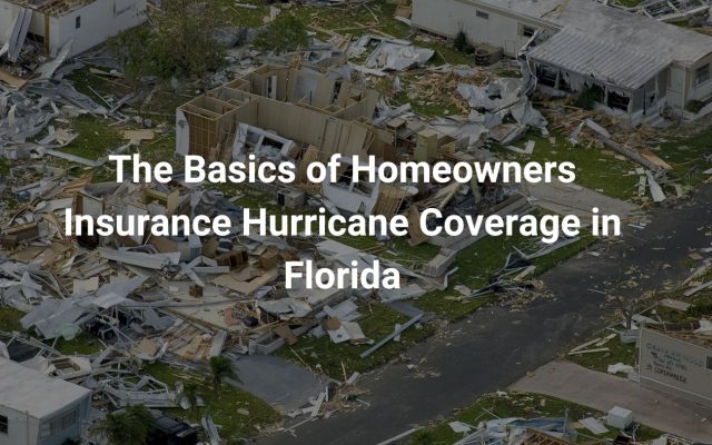
Stronger hurricanes grab headlines, but your own zip‑code choices make losses spike. Coastal population along the Gulf and Atlantic has grown nearly 40 % since 1990. Waterfront condos, high‑tech ports, and sprawling beach towns now sit where dunes once absorbed the surge. Today, even a fast‑moving Category 1 can cost billions because it hits more buildings packed with pricier electronics—and because residents like you expect power, internet, and supply chains to bounce back immediately.
Insurance and Wallet Pressure You Can Feel
Rising losses translate directly into rising premiums. Over the past five years, average homeowner hurricane deductibles in coastal counties have jumped by as much as 35 %. Some carriers have pulled out of states like Florida and Louisiana altogether, pushing you toward state‑backed insurers of last resort that often provide thinner coverage. The result? Even if your roof survives the storm, your budget faces a different kind of gale. Building a disaster fund ahead of time now sits alongside boarding up windows and filling sandbags on your preseason to‑do list.
What the 2025 Outlook Tells You
Government forecasters call for 13–19 named storms, 6–10 hurricanes, and 3–5 major hurricanes in 2025—an “above‑normal” label yet again. They also peg the ACE range at 90–160 % of the median, so a single stubborn hurricane could blow the season’s energy score past the high end. With sea‑surface temperatures already running record‑warm this spring, the stage is set for quick spin‑ups and hectic tracking.
How You Stay Ready When Watches Turn to Warnings
You can’t control the climate drivers, but you can shrink your personal risk:
- Know your zone – Check local surge and flood maps right now so evacuation orders never surprise you.
- Fortify the envelope – Simple upgrades like water‑barrier tapes on windows, sealed soffits, and reinforced garage doors keep wind‑driven rain out.
- Secure power backups – A portable generator or battery bank lets you chill meds, run fans, and keep phones alive when the grid goes dark.
- Document your assets – Fresh photos of your roof, siding, electronics, and important papers accelerate insurance claims.
- Build neighbor networks – Swap contact numbers, share gear, and plan who checks on whom when roads turn into rivers.
- Run drills – Time how long it takes to board windows or hitch the boat; shave minutes now, spare panic later.
Stay Ahead of the Storms
So, are Atlantic hurricane seasons getting worse? Yes—both in sheer numbers and in the muscle each storm can flex. Warmer oceans, favorable wind patterns, and booming coastal development all conspire to raise the stakes. Yet knowledge and preparation shrink the threat. By following the steps above—long before a name pops up on the weather crawl—you keep control over everything that truly matters: your safety, your family’s comfort, and the speed of your recovery. And when the wind finally dies down, you’ll also protect your wallet and earn peace of mind, no matter what the forecast throws your way.